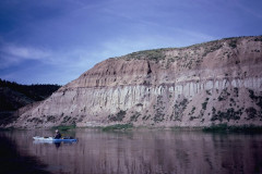
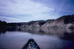
6/5/20 to 6/12/20 149.5 miles
By Mat Bozek
“Welcome to the Upper Missouri River Breaks National Monument”
This trip has been on my “to do” list for a long time. I’d originally planned on doing it solo, but decided to offer it as a RMCC club trip, and scheduled it for a May 9th start date. The Corona Virus outbreak put a big kink in that plan. I kept in touch with the outfitter (for shuttle) and some of the people who seemed most interested. Problem was that Montana had imposed a 14 day quarantine on anyone entering the state, so we had to wait till that was lifted, which turned out to be June 1st. I was worried that an upsurge in cases might cause MT to reestablish the quarantine, so I wanted to do this as soon as I could make it, and called the outfitter to set up the shuttle for June 5th. I contacted some of the people I thought would still like to go, but most of them couldn’t make it on such short notice. It would just be me, and Tracy and Janet (T/J).
T/J used their 16’ sea kayaks and I used my Rendezvous, so I knew we could make good time and not be too bothered by the high winds that this run is notorious for. I’d already done most of the planning and only needed to polish up the plan a bit.
There are two map/guide booklets that cover this section of river; Fort Benton to Judith Landing (88.5 mi) and Judith Landing to James Kipp Rec. Area (US hgy 191). These are very good detailed and accurate guides – all you need for the trip. If a grove of cottonwoods is shown, or a drainage, you can find it on the map so it is very easy to navigate and plan for camps and hikes.
That was unusual for me, to know where I was all the time. Everything of note and interest were described and noted as to mile marker, and they show public and private lands. Seems like there were two BLM districts, as most of the points of interest and camps had signs on the upper half, but none had signs on the lower half, though it was still easy to find the camps and points of interest. They cost only $4 each – I’d bought the first one while passing through in 2017, and downloaded the second from the BLM website for planning purposes.
You can camp anywhere on the public lands, and between the high-water marks of private land, but the islands are off limits from 4/1 to 7/31 due to nesting eagles. Most of the islands didn’t look worth camping on anyways, due to how brushy they were, and poor landings. BLM provided 3 types of established camping areas: “Developed Boat Camps” had fire rings, outhouses and mostly had fencing to keep cattle out – two had “sun shelters”, two room open leantos; “Primitive Boat Camps” only had fire rings, and some had fencing also. “Developed Public Access Sites” were roadside campgrounds – we used these to dump trash and wag bags a couple of times.
There are two flow gauges for this section of river – one at Fort Benton, and one near Landusky, MT which is more or less the take out. May and June are the highest water levels. Avg flows for this time of year were @ 15,000cfs at Ft Benton and @ 20,000 cfs at James Kipp – the difference being the Marias and Judith Rivers entering below Ft Benton. Use Ft B until Judith Landing – below Judith, use the Landusky numbers.
Day 0 – I arrived in Ft Benton @ 11 am on Thurs 6/4. Drove @550 miles Wed, and @250 Thurs – its just short of 800 miles for me. I drove around the town locating the “Canoe Camp/Put In” and stopped at the Outfitters to deal with shuttle arrangements, and had lunch. T/J arrived @ 2pm and we set up camp right next to the put in – only had to carry gear and boats a100 feet to the water. There’s a radio receiving station there, to pick up signals from “radio collared” sturgeon, one of several along the river. We went to the BLM interpretive center to check it out (i’d been here in 2017). Supposed to be a $5 fee, but they never charged us – think it was because that fee also covers admission to two museums in town that were closed due to the virus. You can buy the map books here, and pick up various free literature.
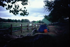
Day 1 – 6/5/20 Friday Tracy and I drove our vehicles to the outfitter’s barn and met with Nicole and Jim, our driver, and left there at 8 am for the 150 mile (one way) drive to the take out. Got back to the putin at 1:15 and were on the water by 1:30. Damn, but the boat was heavy! Like paddling a barge not a canoe. I had 8 days food, and 9 gallons of water aboard. You need to carry all your drinking water (might be water at Coal Banks) because the river water has ag runoff including pesticides and herbicides, and is thick as chocolate milk with sediment. Got to camp at “Senieur’s Reach” primitive boat camp about 4:30 and set up camp. There was supposed to be fencing to keep cows out here, but there was plenty of evidence that the fence wasn’t working. Quite warm, but a pleasant evening with some mosquitos.
Mile 0 to mile 16.5 = 16.5 miles today Flow (Ft B) 10,500 cfs / (Landusky) 15,800 cfs
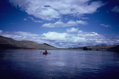
Day 2 – 6/6/20 Saturday – We were all early risers, getting up at first light, which is around 5 or 5:30 this far north, and shoved off at 6:45. We made a stop at the Loma Bridge to do the “Decision Point Overlook Trail” – this was where Lewis and Clark spent some time trying to decide which was the real Missouri River – the right fork (The Marias R) or the left (the Mo.). This was about a one-mile round trip hike, with interpretive signage. Saw one RV camped at the bridge RL and one other fisherman there on RR. We made it down to Coal Banks landing @ 12:30 (mile 41.5) – 25 miles in 5 hours including the time we hiked. Had some headwinds today, especially when the river bends more eastwards, but good current running 4.5 to 5 mph.
A stop at Coal Banks Landing is mandatory, to pay your user fees for paddling the river – $4/per person/per day for every day below Coal Banks. Had lunch here and spent some time chatting with the BLM ranger, and checking out the displays in the office. Headed out on the way to “Little Sandy Developed Boat Camp” at mile 46.7, only accessible by river, with 1 outhouse and 2 fire rings. Left Coal Banks at 1:15 and got to Little Sandy at 2:15. About a mile above camp I saw two canoes ahead, and they were stopped at the camp for lunch as we pulled in. This is a nice camp, with fencing to keep the cows out – downside to that is no grazing, so the grass and weeds are 2 to 3 feet tall. Wandering around in that finding some firewood made me think about all the warning signs posted about rattlesnakes. After setting up camp, we all took a hike uphill behind the camp. Eagle Eye Tracy spotted some (3) teepee rings on the high points – just a collection of rocks in a circle used to hold down the bottom of the teepee, about 15’ in diameter. It looked like it might rain (had been cloudy most of the day) so we had set up tarps over the tents. It did rain and blow quite hard during the night, but we stayed dry. This was our planned camp for day 2
Mile 16.2 to mile 46.7 = 30.5 miles 10,800 cfs (Ft B) / 15,200 cfs (Landusky)
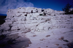
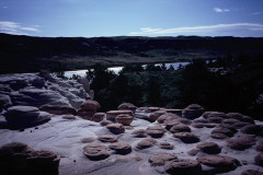
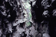
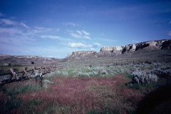
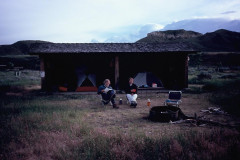
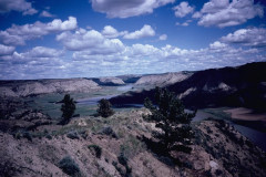
Day 3 – 6/7/20 Sunday On our way at 6:45 heading for “Hole in the Wall” camp. Stopped at mile 53.5 to hike and explore around the remnant stone walls of Monroe Cabin and the white sandstone bluffs above it. Paddled on down to Eagle Creek camp to do 2 hikes there. When we pulled in, we met up with that same 2-boat group camped there, just breaking camp now – this was the last time we would see any other paddlers on the river. We hiked a mile or so up Eagle Creek, and then a mile or so up “Neat Coulee”, a tight slot canyon thru the gray sandstone. My wading shoe sole started to delaminate in the coulee, so I headed back to the boat early to make temp repairs. Then we paddled on down to Hole in the Wall camp, getting there @ 1:30 or 2. This is a “developed boat camp” with two sun shelters (2-room leanto) and 4 fire rings. This would be the only camp we used without any cottonwood trees, which was the reason for the shelters, though there were many small trees planted in fencing to be hand watered, and many with big reservoirs for drip irrigating upriver of the camp. It was fenced to keep the cows out, which was good since there was a small herd nearby. It looked like more rain possible, so we set up our tents in the shelter. Once camp was set up, we decided to hike towards the hole to see if we could find the trail up to it, thinking we would do that hike in the morning. Except we found the trail and just kept hiking up, climbing up one “iffy” sandstone section to get to the ridgeline above the hole, then down the back side to the approach. T scampered up and convinced J and I that it was easy enough, and we all took in the views from there. On the way back, wanting to avoid that iffy spot, we followed a fainter trail down and around the back and then back up to a point we could pick up our original route – this was a much easier way to go if you could find it. Made it back to camp about about 5 and had dinner. The sky was definitely getting darker with a brewing storm, and by evening we were treated to a great light show off to our south. Much of the lighting was going horizontally, cloud to cloud. It did soon rain on us, fairly hard, but we stayed dry in the shelter. Someone had left 5 or 6 chunks of firewood in the shelter and I had split them with my machete to prepare for a fire, but no fire tonight with that storm and I would just carry the wood down to the next camp.
Mile 46.7 to mile 63.0 = 16.3 miles 13,000 cfs / 15,000 cfs
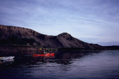
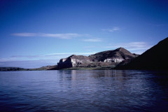
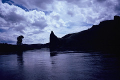
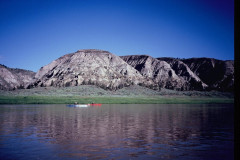
Day 4 – 6/8/20 Monday Up early as usual, and misting and the weather was looking like more rain. A big downside to rain was that it turned the dirt into slick sticky mud which clumped onto our shoes as we moved around and loaded the boats. The original plan for the day was to go down to “The Wall” camp, and perhaps stay 2 nights there – I’d built in a layover day. But with the weather looking to be wet, I changed the plan and decided to use that extra day and just do a short day down to “Slaughter River developed boat camp” which had the only other shelter on the river, and I preferred to camp inside of it. That would keep the tents dry and we wouldn’t have to camp on mud or in the 3’ tall wet grass. This was kind of in the heart of the White Cliffs section – very scenic with bands of dark igneous rock protruding 90 deg. from the white sandstone layers. “Hole in the Wall”, “Dark Butte”, “Steamboat Rock” and “The Seven Sisters” were all landmarks we passed today. We didn’t stop to hike because of the sticky mud, and the white sandstone got crumbly. Taking our time, we got to the camp by 10:30 – it was only about 14 miles; think we left @ 7:15 or so. This camp was enclosed by a fence and had several fire rings as well as the shelter. Slipping and sliding and clumping our way up the 6’ steep bank was tricky, but we got all our gear up and pitched our tents in the shelter. If there were other people camping here, we couldn’t have done that, as the shelters are meant to be shared by everyone – nice having the place to ourselves. I walked around and scavenged some more chunks of firewood left at one of the fire rings, which I split with my machete to get it ready for a fire later. I called this a rest day, and hung around camp, taking advantage of the time to shave and clean up. T&J went hiking up the hill in the mud for 3 or 4 hours and got back just before it rained again. This was the only “cold” day we had – I wore my raincoat all day, and when the temp dropped as a front went thru I added my fleece jacket to stay warm. Since it was raining, no fire tonight, and I’d just haul the wood with me to the next camp. Wood is scarce at these camps.
Mile 63.0 to mile 76.8 = 13.8 miles today 16,000 cfs / 18,000 cfs
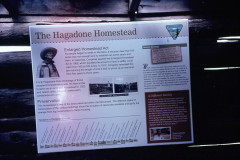
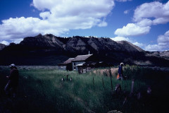
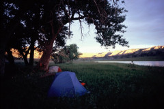
Day 5 – 4/9/20 Tuesday The water rose some last night, perhaps 6”. Up early and headed for a stop at Judith Landing – we could dump accumulated trash and wag bags there in a dumpster. We pulled in at the boat ramp below the bridge and took a short walk downriver to check out some more interpretive signage and a bronze plaque of Lewis and Clark’s campsite. This area had been the site of two major “councils” – one of the signs had said that 18,000 Indians had camped in the vicinity for one of them, so it was a pretty big deal at the time. On our way again, we passed several more homesteads and several more named rapids (all “no shows” at this level) today. One planned stop at mile 97 was at the Hagadone Homestead, the best preserved one which still had some furnishings inside the cabins and lots of old farm machinery about the place – in a very nice setting. Our next stop was at the McLellan-Stafford ferry to do a hike up the “Old Army Trail”. You are warned to not approach upstream of the ferry, so we eddied out below it to – surprise! no eddy and very fast current, and two fishing poles the ferry operator had out in the water that we had to dodge. We chatted a bit with the ferry operator, getting some of the local history and color, then went for our hike. Took us about an hour and 45 min to get to the ridgeline (900’ el gain) which seemed awfully slow for a 1.75 mile hike (3.5 miles round trip according to the guidebook) when we got back to the start and read the sign there, it said 3.5 miles “one way”! which seemed more accurate to me for the time it took us. Great views of the river from the high point. Back in the boats and headed for “McGarry Bar” primitive boat camp. Hopes for a cold draft beer were dashed when we arrived – the bar must be a gravel bar named from the old steamboat days as were most of the other landmarks. Nothing there but an overturned fire ring (strange) and giant cottonwood trees, some nearly 5’ in diameter. No fencing, but no cow pies either and mostly all tall grass and brush to set tents on. There was another commemorative plaque here for a Lewis and Clark camp which I did manage to find in the tall grass. Spent a pleasant evening around a fire with a few mosquitoes
Mile 76.8 to mile 103.3 = 26.5 miles 15,700 cfs, 18,000 cfs
Day 6 – 6/10/20 Wed. – When we’d landed yesterday there was a steel post sticking up above the grass and I went to it to see if it had a sign. There was a sign, down at the base of the post, barely visible in the tall grass – I could see the words McGarry Bar, and went to unload the boat. This morning I thought I’d maybe try to get the sign up to the top and make it visible. That’s when I read “the fine print” which said that this site was close to protect nesting eagles. Oops! Well, I didn’t see any eagles there in any case. We got our normal early start and headed for “Gist Bottom primitive boat camp”. There were 5 more named rapids today, again all no shows. I think we only encountered any waves at maybe 2 of the rapids, and just small waves. We did one stop for Middleton Homestead and got to Gist by early afternoon. Much like the other camps, lots of tall grass and cottonwoods, but nowhere near as large as those at McGarry Bar. After setting up camp we hiked up to the Gist homestead and checked out the buildings and equipment there, then headed for the Ervin dugout. But there was Bullwhacker creek to cross, and it was all mud. T engineered a crossing that worked for him, but J and I just headed back to camp. Before we’d started our hike J heard and spotted a group of 8 or 10 Bighorn sheep high up atop the cliff across the river. They just hung out watching us for an hour or two, and eventually drifted down the ridgeline and out of sight – T saw them again from the dugout. There was a pile of sawed up post fencing nearby – a pole fence that was joined together using big lag bolts – they just sawed what they could and left the bolts holding the rest together – I did manage to get a few loose pieces to add to our firewood supply – it would need a wrench to take most of it apart for firewood. Another pleasant evening around the fire.
Mile 103.3 to mile 122.6 = 19.3 miles 15,700 cfs / 20,000 cfs
Day 7 – 6/11/20 Thurs. An early start and a mile paddle got us to the start for the “Snake Point Hike” where “One can literally hike in the footsteps of Captain Clark” – if you could follow the vague directions and if this was really where Clark hiked up to get his first view of the mountains. As usual since we’d left Judith Landing, there was no sign to indicate where exactly to start, so we guessed and hiked up the main drainage and then left and up making it up to a ridgeline above Gist Bottom – about a 650’ elevation gain – I didn’t see any mountains – maybe it wasn’t the right spot. (I tried to find “Snake Point” on a topo map, but failed at that too). Giving up, we retraced our route back to the boats and back on the river. Our next stop was going to be at the Kipp Homestead. Getting close to it, I spotted a bit of roofline and we pulled over to find nothing but two outhouses, nicely labeled his and hers, and nothing else ? then could see the roofline of a building farther downriver so we went farther down but missed where we should have taken out, and just kept going. Went on down river to the Lower Woodhawk camp where we pulled out to do a hike of about a mile to the Nelson Homestead, which was upriver but not easily accessed from the river. More old buildings (with some repair work having been done)
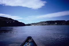
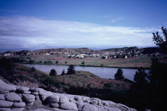
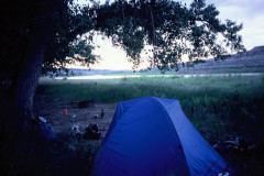
and old farm machinery out in the deep grass, and again I think how good a place this would be for a rattlesnake to hide out, but none there it seemed. We were now pretty much out of the badlands section, now into more ranchlands, and getting a touch of civilization by seeing a motor boat that had come up from the 191 bridge. Returning from our hike, we had lunch at the camp using their nice picnic table. Here T discovered to his dismay that he had lost most of the pictures he’d taken in the past 3 or 4 days – seemingly a bad memory card, though he did have a few just taken here. Sometime later as we were paddling along we saw a family on the left shore and suddenly the kids all ran off to see what their dad had caught. So I moved closer and asked what they’d caught – “A paddlefish” – OH! Can we see it? and we all got to the bank and could see the big fish before the guy threw it back into the river. – it was at least 4’ and maybe 5’ long. A few miles later, we got to “Hideaway” primitive boat camp where we were going to camp – it is the last camp marked on the maps. Virtually no landing here, I got out and with stupendous effort managed to get my boat up the steep four-foot bank and out of the way, then T landed and we hauled his boat up and then J’s boat too – just flattening out the willows for a place to leave them. Like all the other camps except Hole in the Wall, lots of cottonwoods and tall grass, mud and one fire ring. Not a bad place, but it might have been better to stay at Lower Woodhawk instead, especially for larger groups. The river was wider and a bit slower today.
Mile 122.6 to 136.7 – 14.1 miles 12,000 cfs / 20,000 cfs
Day 8 – 6/12/20 Friday We only had 12.8 miles to go to get to the takeout, and paddled all of that into a light headwind. Nothing of note to stop for along the way, so we didn’t stop and got to James Kipp @ 10:30 or so — to a big surprise! As I rounded the corner into the boat ramp, I was met with a big crowd of people, 30 to 40 of them taking up the whole ramp. I managed to squeeze in between two of their boats with just enough room to unload. This group was an annual fishing event of an extended family and friends – they had a big cage with maybe 50 big catfish in it, and they had several tables spread out to use for cleaning them – the fish I saw were all in the 2 to 3 foot range, and, must have been 200 to 300 lbs of them all told. We just hauled our gear up to the parking lot where we could drive to and then load our boats. Those people were dumping garbage cans full of catfish carcasses into the river right there at the ramp, so we didn’t want to try to clean off the mud in that mess. Loaded up and headed for home and the nearest ice cream.
Mile 136.7 to mile 149.5 = 12.8 miles 12,000 cfs / 19,000 cfs.
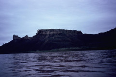
Epilogue: This turned out to be a great trip. We had good weather for the most part; mostly pleasant paddling, no rain while we were on the water, and only the one “cold” day. The wind wasn’t a big problem, though it blew some every day; the current was about 4 to 5 mph for the most part. The flow was below average to near average for this time. Mosquitos were a bit of nuisance except in the mornings, but not really too bad. J picked up quite a few ticks, but I only had one on my pants. Saw lots of eagles and pelicans, maybe 50 of each? – seemed that many anyways, or even more. Saw several deer every day but the last – they seemed to prefer bedding in the willows lining the shore and on islands and would jump up when we got near. I saw one muskrat, and a couple of beavers, and Osprey 2 or 3 times. Best thing was that we virtually had the river to ourselves – only saw that one other group with 2 tandem canoes, and maybe 5 or 6 motor boats. Lots of hiking opportunities too. There were sort of 4 sections to the river: first rangeland, then the white cliffs section, followed by a badlands section, then more rangeland. I hadn’t brought any firewood along, but got lucky and found some left at 3 of the camps, enough for 4 or 5 fires – really need to bring some with you. No doubt, this is a “Do again” trip. Sometime between mid-May and mid-June would seem to be best.

