By Dan Custer
Normally I would not think a morning paddle on Chatfield Reservoir would be worthy of a trip report. Now I think it is worth at least one report. If you did not already know, Chatfield Reservoir is super full of water, more than ever before. You can now paddle through a cottonwood forest. This is the result of the Chatfield Storage Reallocation Project and the significant runoff this year.
Kit and Henry have been to Chatfield a half dozen times this spring and have seen the changing water levels. I have been with them a couple of times and the change I saw between May 3 and June 9 was dramatic.
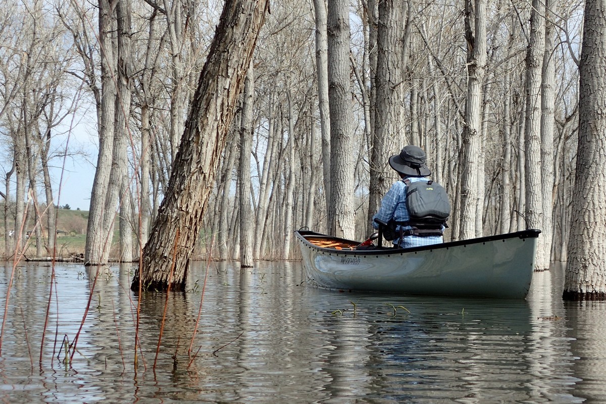
On June 9 Kit, Henry, Bill, and I did a run down the South Platte down to the reservoir that was a unique experience for me. Kit and Henry scouted where to launch and found a spot just downstream from a diversion dam. I didn’t inspect it, but from downstream it looked like a low head dam. The parking was at the Audubon Nature Center, which is not right on the river but there is a nice path to portage the quarter mile to the river. At 500 cfs on a sunny day, the float was beautiful with enough water to keep from scraping the bottom. I would call it a Class I+, as it did twist a bit, had some small rapids, and the potential for large snags. The only downed tree to dodge was an old bleached cottonwood with no branches that had several gaps to safely paddle through. By the time we got to that tree the current was minimal and the reservoir was beginning. It was short run on the river. About 1.3 miles from the put-in until the Platte faded into Chatfield. Shortly after entering the still water, we left the river channel and began paddling through the cottonwood forest.
I was astonished at how much water was in the forest. It had been only a month prior that my daughter and I were at the very same spot looking for and finding morel mushrooms. Now all those trails, brush, cactus, wild roses, mushrooms, and ticks are under water. We paddled though the trees and ventured into a pond that used have a trail around it, a trail I had walked on a few weeks before. Then we paddled back to the river channel and paddled it out to where it used to empty into Chatfield. The inlet was missing a large beaver lodge. On a previous trip, Kit got a picture of beavers floating on a debris raft in the mid-day sun. An unusual sight, probably caused by losing a lodge.
After seeing the flooded forest, I wanted to know a little more about the Chatfield Storage Reallocation Project. I found several web pages proclaiming the benefits. The information that was most interesting to me was an opinion published by the Sierra Club in 2012. Overall, the Sierra Club approved the proposed project, saying among other things that this project would be much better than diverting water from Flaming Gorge (Green River) to the Front Range. I had no idea that a plan to deplete the Green was ever a consideration. If the Chatfield Storage Reallocation Project helps take a Flaming Gorge diversion off the table, I think it is a big plus. I was concerned about riparian habitat loss at Chatfield, but if it means a sustained flow for river habitats downstream, then maybe it is a good trade off.
Dan
More information and pictures.
Coordinate for the put-in is N 39.49561 W 105.08692.
Chatfield water level https://www.denverwater.org/your-water/water-supply-and-planning/supply-data-and-reports/reservoir-levels?field_valid_date_value=2023-06-09
Strontia outflow = ~ Chatfield inflow (hourly updates) https://dwr.state.co.us/Tools/StationsLite/PLASTRCO?params=DISCHRG
Sierra Club’s comments in 2012 https://www.sierraclub.org/sites/www.sierraclub.org/files/sce/rocky-mountain-chapter/issues/chatfield_reallocation.pdf
Introducing: Your new, expanded Chatfield Reservoir by Denver Water https://www.denverwater.org/tap/introducing-your-new-expanded-chatfield-reservoir?size=n_21_n


