Dates: September 5 – 11, 2023
Report Submitted By: Debbie Hinde
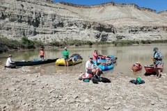
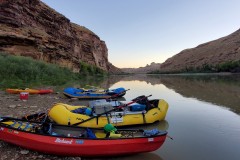
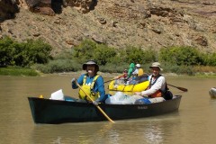
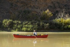
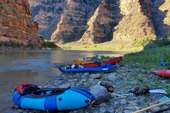
We had 12 Participants on this trip: Debbie, Micki, Lynne, Steve, Sally, Roger, Merlin, Deni, Karen, Carey, Dave, and Claire. We had two rafts, one Ducky (IK), one hardshell kayak, one sea kayak, one packraft, one tandem canoe and 3 solo canoes.
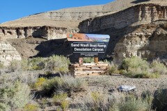
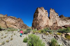
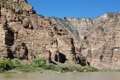
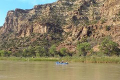
This is an 84-mile trip on the Green River starting at the Sand Wash Ranger Station and ending at Swasey’s Boat Ramp near Green River, UT. The rapids are rated up to Class IV, however, since we went in the fall when the water level was low (2700 cfs), the most difficult rapids were Class III. The scenery is amazing, the riffles and rapids were fun and there are numerous hikes and historic sites to see depending upon your timeframe. Per the BLM, you can choose from as few as 3 days (for 84 miles??) and up to 9 days to enjoy this section. We opted for 7 days and next time I will pick 9! A permit is required year-round and may be obtained through the annual lottery from December 1, thru January 31, via https://www.recreation.gov/permits/233393 . You can also find more information here: BLM-Website-for-DesolationGrayCanyons.
Before you launch, each boat is given a tag that must remain visible on your boat for the duration of your trip. One side of this tag has the following quote from Major John Wesley Powell, July 8, 1869: “…the region is cut into a wilderness of gray and brown cliffs…We are minded to call this the Canyon of Desolation.” Sorry to disagree Major Powell, but the canyons are majestic and beautiful to our eyes!
Here is a synopsis of our trip:
Day 1: 9/5/23 – Sand Wash Ranger Station & River Access to Mile 81.8 Camp. 14 Miles
The Ranger, John, was very thorough and inspected the fire pan, 1st aid kit per boat, throw ropes, groovers, extra paddles/oars, repair kits and epoxy dates, PFDs and anything else on the ‘required list’. Older and/or frayed/torn PFDs are not permitted as we saw him rejecting some from another group. Not having the proper gear can keep you from being able to launch!
This first day is mostly flat water with minimal current. The weather was clear and hot and we had a lot of paddling/rowing to get to the first set of good sized camps.
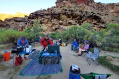
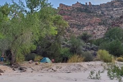
Mile 81.8 Camp is a nice, alcove camp which was just big enough for our group of 12. Access is via a somewhat steep, sandy bank. Sites are scattered within the brush. There were several Orb Weaver spiders making beautiful webs.
Day 2: 9/6/23 – Mile 81.8 Camp to Mushroom Rock Camp, mile 68.8. 13 Miles
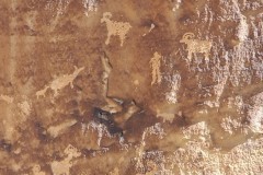
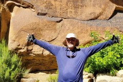
The day started out sunny and hot but the wind came up in the afternoon much stronger than forecasted. We did stop at the Rock House Petroglyphs for a short hike.
The river is mostly flat in this section. The Rapids this day were all easy. Jack Creek, listed as a II-III, was a II- at this level which we scouted from big rock bar on river-right.
Mile 68.8 camp was nice with lots of sites tucked in the brush.
Day 3: 9/7/23 – Mushroom Rock Camp 68.8 to Steer Ridge Camp 56.4. 12.4 Miles
The paddling/rowing gets a bit easier now as the current picks up thanks to a bit of gradient. We were all looking forward to that!
On the way, we stopped at Flat Canyon to see the Petroglyph Panels at mile 63.3.
Steer Ridge Rapid at mile 56.7 had a new rockfall on river-left. We stopped to scout it on river-left as suggested by the Ranger and as permitted by the Ute tribe for this rapid only. Otherwise, there is no river-left access until after Coal Creek. The rafts took the left channel which needed one move towards the bottom. Many of us took the middle channel which proved to be easy.
We arrived at Steer Ridge Camp early which gave us time for swimming and relaxing. The camp is a nice beach camp with afternoon shade but there were a lot of flies, yellow jackets and gnats. We did notice a fire off in the distance and ash began falling on our gear. We were never in danger from this fire – whew! We had used our Garmin Inreach devices to text a friend to verify if the fire was a problem and found out it was not.
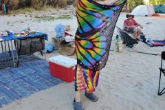
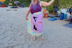
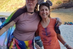
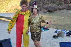
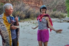
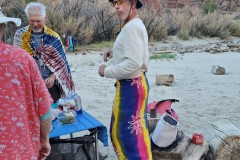
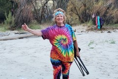
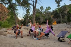
This early stop at camp gave us time for our planned ‘Fiesta Night’! There were great costumes and a shared fiesta meal. See the pictures for samples of some of this fun!
Day 4: 9/8/23 – Steer Ridge Camp 56.4 to Chandler Falls Camp, 47.2. 9.2 Miles
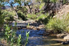
As planned ahead, we stopped at Rock Creek, Mile 54, just above the creek to filter water. It is best to walk up the creek via the trail to the deeper pools to filter. Do not filter at the mouth of the creek as people can be walking through the creek above stirring up extra silt.
All rapids in this section were read and run.
Chandler Falls Camp was a nice camp although buggy in the trees. Again, it was nice to be in camp early enough to swim, set up, etc. We scouted Chandler Falls from camp as it was right below us.
Day 5: 9/9/23 – Chandler Falls Camp, 47.2 to Above Wire Fence #2, 37.1. 10.1 Miles
There were lots of rapids in the beginning of the day to keep us moving. All were read and run.
Joe Hutch Creek labeled III-IV in the book was barely a 1+ !
We scouted Joe Hutch Canyon on river-right. There is a trail or you can walk on rocks for the scout. We all took the left channel and stayed to the right on its main tongue. The rapid was fun and not difficult.
Above Wire Fence camps #1 and #2 were open. Both had slightly steep, rocky landings which weren’t great. #2 was closer to the rapids we wanted to scout so we stayed there. The bugs were really bad here. No mosquitoes but biting flies and gnats.
We scouted Wire Fence and Three Fords from this camp. There is a bit of flat water between these rapids so you don’t have to scout both at the same time if you don’t want to. The trail to scout Three Fords has some tricky parts to see the big waves.
Day 6: 9/10/23 – Above Wire Fence #2, 37.1 to Poverty Camp, 25.2. 11.9 Miles
Some chose to run Wire Fence rapid right after launching. Some scouted again before running it. My line, as a solo canoeist, was right down the main tongue of the left channel and stayed to the right.
Several continued on and ran Three Fords while some stopped on the left side on the rocks at the top of the channel to re-scout.
I remembered that the best run for me was to keep the rocks immediately on my left. The run is on the left side of the right channel (the only channel at low water). Canoes can sneak between the last big rock and a low, black sleeper right at the ledge and it’s easy from there. There are some big waves to negotiate otherwise. The rafts had to run the big waves and they’re also fun for skirted kayaks and self-bailing boats that want the challenge.
Next came Coal Creek rapid. DO NOT do what the river book says and scout it from the far-right channel! Once you go down that channel it is hard or impossible to see the rest of the river. Stop above the bend (or for rafts stop well before the bend) and walk down if you want to scout it on the right. Several of us stopped on the gravel bar that was in the center and then paddled over to the rocky channel on the left. This reminded me that I like the running this down the left side of the channel keeping the impassable, rocky channel immediately on my left.
All the subsequent rapids that day were easy to moderate II’s. Range Creek was fun and a bit bigger than expected.
We had hoped to make more miles but not too long after Coal Creek, the wind came up suddenly and extremely strong so we had to stop and stay at Poverty Camp. This is a beach camp with just a little bit of cover. If the wind kept up it would have been bad but it eventually died down after we were there a while. The wind kept the bugs away and the camp was okay after all.
Day 7: 9/11/23 – Poverty Camp 25.2 to Swasey’s Boat Ramp, 11.9. 13.3 Miles
This was our last day. We stopped just above the Price River for a short walk to see more Petroglyphs.
There were a few fun and easy rapids on the way. The last, Swaysey’s rapid, was a blast! Longer and more fun than I remembered. Look for the ramp on river left. It’s best to stop on the upstream side of the ramp as it’s on a bend and the water wants to take you past the downstream side if you’re not paying attention.
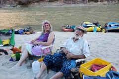
I hope you enjoy our photos!

